‘3D pointillism’: LiDAR paints detailed pictures of field, forest, and carbon storage
This laser-based remote sensing technology is one of the most powerful tools we have for studying landscapes.
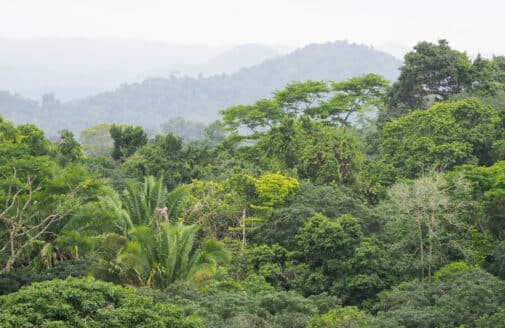
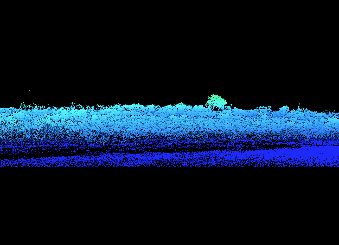
LiDAR scan image of a forest-cropland edge at Tanguro Research Station in Brazil.
image by Manoela Machado
Despite thorough preparations, flying the drone is still nervewracking.
Dr. Manoela Machado, a Research Scientist at Woodwell Climate, has double- and triple- checked her calculated flight path over a study plot in the Cerrado, Brazil’s natural savanna. The drone can essentially fly itself, and she’ll be monitoring its speed, altitude, and battery life from her handheld controller on the ground, but many things could still go wrong. High winds, an unforeseen obstruction, loss of connectivity— all could jeopardize the mission, potentially dropping the expensive equipment 40 meters into the woodland canopy below.
Aboard Machado’s drone sits a powerful piece of technology – a LiDAR sensor. Developed originally for use in meteorology, this remote sensing technique now has widespread applications across scientific fields, from archaeology, to urban planning, to climate science. At Woodwell Climate, Machado and others employ LiDAR to create detailed three dimensional models of landscapes, which provide valuable insight into the structure of ecosystems and the amount of carbon stored in them— all with just a few (million) pulses of light.
Manoela Machado lands her drone after a flight over Araguaia State Park in Brazil.
photo by Manoela Machada
What is LiDAR?
LiDAR stands for Light Detection and Ranging. Put simply, it is a sensor that uses laser light to measure distance.
Similar to other technologies like sonar and radar, which use sound and radio waves, respectively, LiDAR is an example of an “active” sensor. “Passive” sensors like cameras collect ambient light, while LiDAR actively pings the environment with beams of laser light and records the time those beams take to bounce back. The longer the return time, the further away an object is. That distance measurement is then used to calculate the precise location in three-dimensional space for each reflection.
This process is repeated millions of times during a single scan, resulting in a dense cloud of point locations. With some advanced computing, the data can be assembled into a 3D picture of the landscape.
“It’s effectively three dimensional pointillism,” says Woodwell Climate Chief Scientific Officer, Dr. Wayne Walker, who has been using LiDAR in his studies for 25 years.
Far more detailed than an oil painting however, a LiDAR model can reconstruct nearly every leaf, twig, and anthill on a landscape.
“Once you construct that cloud of millions of points, you get to walk inside the forest again,” says Machado. “When you finish processing the data and see the cloud you go, ‘I remember that tree! I remember standing there!’ It’s mesmerizing.”
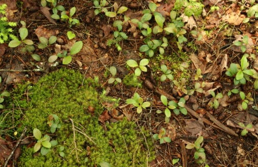
Scanned plot of in-tact transitional Amazon-Cerrado forest at Tanguro Field Station, Brazil.
GIF by Julie Waite and Manoela Machado
For a project like Machado’s, scanning a few dozen hectares, the sensor is usually placed on a drone. Larger study areas require sensors mounted on low-flying airplanes or even satellites, but for small ground-based applications there are sensors one can carry, mount on a tripod, or attach to a backpack. Some newer phone models even have LIDAR apps built in. Regardless of how LIDAR is deployed, it remains a straightforward method of data collection. Just point the sensor at what you want to scan and within minutes, you’ve captured the data for a detailed three-dimensional model of your area of interest.
Estimating the weight of a forest
What Machado and Walker are often after from a LiDAR scan is a measurement of biomass, or the total weight of the organic matter present in an ecosystem. Plants store carbon in the form of organic matter, so biomass measurements are an easy way to estimate an area’s carbon storage.
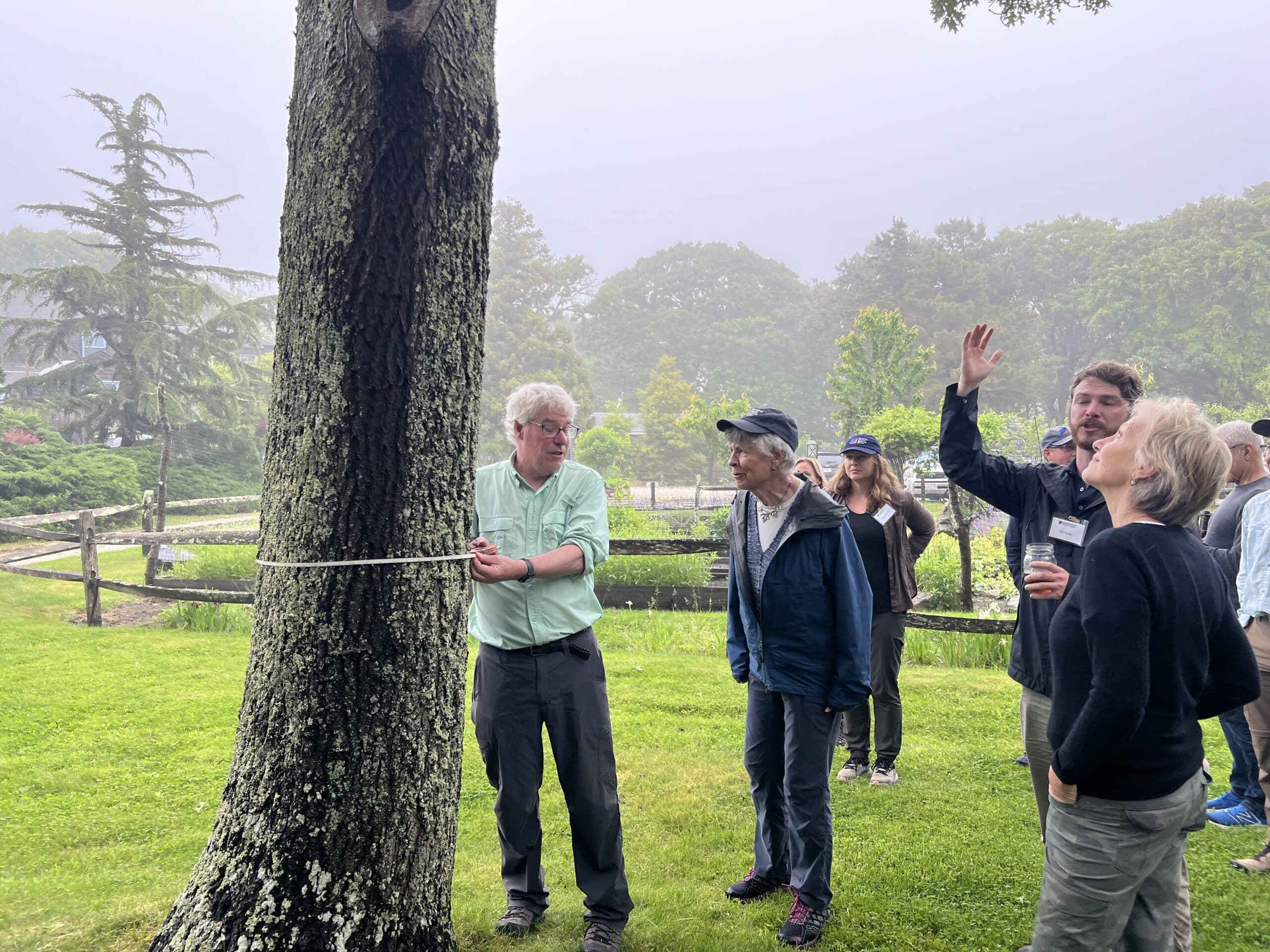
However, measuring a forest’s biomass directly would require cutting down all the trees, drying them out, and weighing what’s left — impractical and needlessly destructive— so scientists use proxy measurements. Walker likens the process to trying to estimate the weight of a human without access to a scale.
“What are the measurements you might use if you couldn’t actually physically measure weight? You might record height, waist size, inseam, and if you obtain enough of these measurements you can start to build a model that relates them to weight,” says Walker. “That’s what we’re trying to do when we estimate the biomass of an entire forest.”
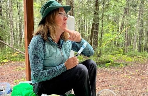
Senior Scientist, Dr. Chris Neill demonstrates how to manually take biomass measurements for Woodwell Climate board members.
photo by Tayler Rogers
Raw LiDAR data is only a measurement of distance, but by classifying each point based on its location relative to the cloud, researchers are able to extract the proxy measurements needed to model biomass across the ecosystem. Before LiDAR, these proxy measurements— things like trunk diameter, height, and tree species— had to be recorded entirely by hand, which limits data collection based on human time and resources. The time-saving addition of LiDAR has vastly expanded the possible scale of study plots. While field measurements are still essential to calibrate models, LiDAR is one of the only technologies that can give scientists enough detail and scope to assess carbon stocks over entire ecosystems.
“There is no other kind of sensor that even comes close to LiDAR,” says Walker.
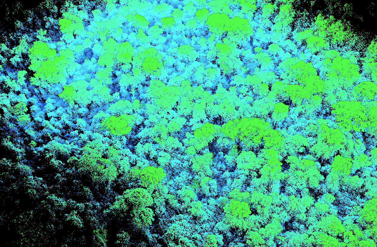
LiDAR scan of an experimentally burned plot of forest bordering agricultural fields at Tanguro Field Station.
GIF by Julie Waite and Manoela Machado
The power and potential of LiDAR
At Woodwell Climate, researchers have employed the power of LiDAR to map biomass and carbon from Brazilian forests, to the Arctic tundra. Outside of the Center, the technology has found applications in archaeological surveys, lane detection for self-driving cars, and topographical mapping down to a resolution of half a meter.
But the detail that makes LiDAR so powerful can also make the data a challenge to work with. A single scan produces millions of data points. According to Geospatial Analyst and Research Associate, Emily Sturdivant, who analyzed LiDAR data for Woodwell’s Climate Smart Martha’s Vineyard project, that wealth of data often overwhelms our ability to extract the full potential of information available in one point cloud.
“LiDAR creates so much data that when you look at it, it’s hard not to be blown away imagining all the different things you could do with it. But then reality kicks in,” says Sturdivant. “It’s challenging to take full advantage of all those points with our current processing power. It’s a matter of the analysis technology catching up with the data.”
Processing LiDAR data requires large amounts of computing time and storage space, especially when performing more complex analyses like segmenting the data on the scale of individual trees. As machine learning and cloud computing technologies advance however, this becomes less of an obstacle, and the potential insights from LiDAR datasets will advance along with them.
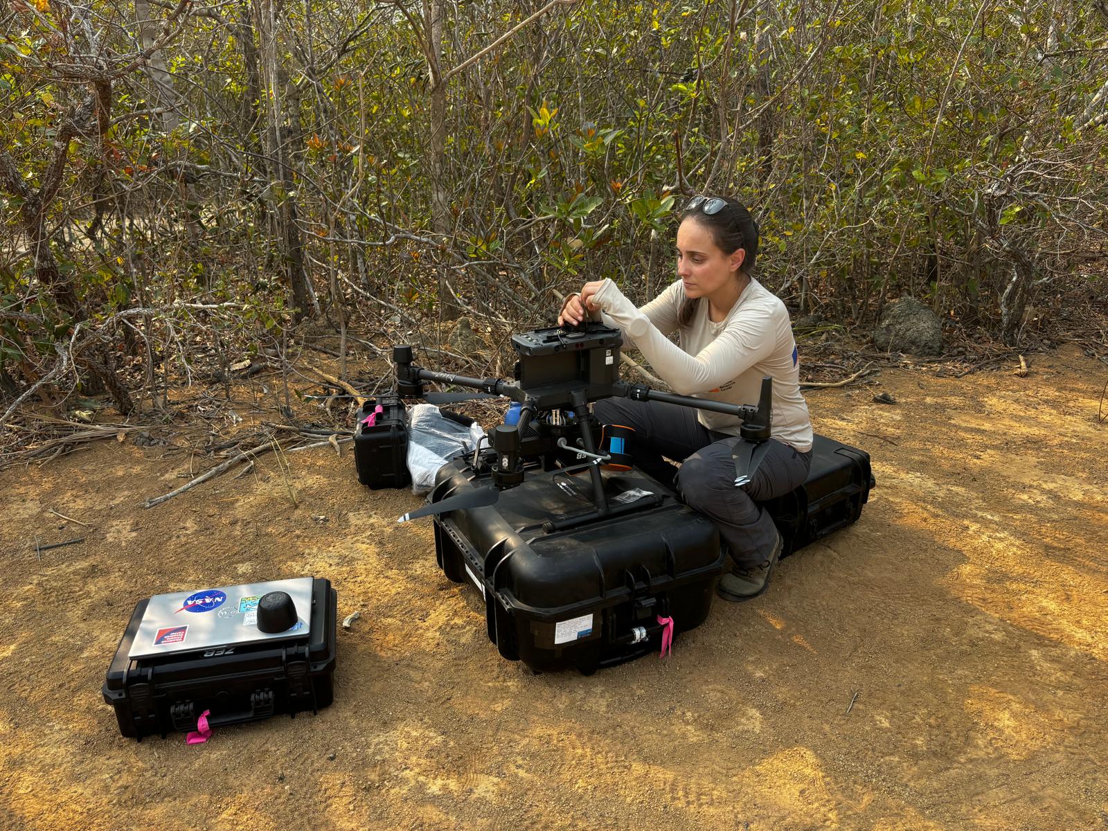
Machado checks drone equipment pre-flight.
photo by Carlos Ferreira
LiDAR can be an expensive endeavor, too. Drones with the right equipment can cost tens of thousands of dollars, as can hiring a plane and pilot and paying for jet fuel, so data sharing has been important in making the method more cost effective. U.S. government agencies like NASA and the USGS have facilitated the collection of LiDAR data through satellites and plane flights, making the data available for public use. Woodwell Climate research has benefitted from these public datasets, using them to inform landscape studies and carbon flux models.
According to Sturdivant, the reliable production of public data has been greatly beneficial to advancing LiDAR-based studies, though it now faces risks from federal cuts to science agency funding.
“One of the greatest advantages of having publicly supported data is the consistency, but that’s exactly what’s now at risk,” says Sturdivant. “Public accessibility has been so important in allowing new scientists to learn and experiment and then help everyone else learn.”
Each new LiDAR scan represents a trove of information that could be used to better understand our changing planet, making it critical to continue supporting and collecting LiDAR data. Its intensely visual and highly detailed nature has made it one of the most powerful tools we have for understanding something as complex as a forest.
“And on top of that,” says Machado “It’s just visually beautiful.”