

November 2025 marked the 30th convening of the United Nations climate conference (COP). Woodwell Climate has been a pivotal player in the annual COP since our founder, Dr. George Woodwell and early staff members, played an instrumental role in the creation of the United Nations Framework Convention on Climate Change (UNFCCC) which enacts the annual conferences. This year was an important milestone for Woodwell due to its focus on tropical forests and nature-based solutions. Woodwell Climate sent 17 staff and scientists to Belem, Brazil, where they spoke at 52 events, and continued the Center’s legacy of advancing science-informed climate policy. Here are 4 takeaways from this year’s conference.
What is COP? Learn more about what goes on at climate’s biggest event of the year in this explainer.
1. COP30 was Brazil’s time to shine
As host country, Brazil used COP 30 to vault themselves into global leadership, to press the importance of international cooperation, and to build bridges between the global north and south. COP30 served as the launchpad for several forest-centered initiatives spearheaded by Brazil, including the Tropical Forests Forever Facility, a new financial solution that would pay tropical countries to keep their forests standing. Woodwell Senior Policy Advisor Frances Seymour and Associate Scientist Dr. Glenn Bush provided input and technical assistance to help launch the TFFF. In addition, Brazil launched a global initiative on wildfire resilience and a global coalition to harmonize carbon markets. Brazil also announced that they will publish two roadmaps in 2026: one to chart the course towards ending halting and reversing deforestation, and another for transitioning away from fossil fuels.
2. NDCs were one of the trickiest issues at COP30
Nationally Determined Contributions (NDCs) are the promises each party country to the UNFCCC makes every five years, to reduce their emissions. Ahead of COP30, countries were supposed to submit their third round of NDCs to raise their ambition. However, many NDCs were missing by the start of the conference, and those presented would reduce emissions only by 10-12% from 2019 levels by 2035, a far cry from the 60% the IPCC says is needed to limit global warming to 1.5 degrees Celsius. The European Union, Latin America, and small island nations attempted to advance this conversation but this was opposed by major emerging economies, who view the NDCs as a commitment to be worked out at the national level.
During several speaking events, Woodwell Senior Research Scientist Dr. Christina Schaedel emphasized the importance of including growing emissions from Arctic permafrost thaw in NDCs and estimates of the global carbon budget. Schaedel’s research has focused on modeling the contributions of permafrost-thaw emissions to sea level rise, temperature increases, and damage costs.
Given strong opposing interests, the issue of NDCs was not resolved by the end of the conference. The UNFCCC instead set up two workstreams to discuss NDC ambition: the Global Implementation Accelerator and the Belem Mission to 1.5. Details about what shape these discussions will take is still forthcoming.
3. Climate finance took center stage
During COP29 in Baku, Azerbaijan, countries agreed to mobilize $1.3 trillion per year by 2035 for climate adaptation and mitigation. Many hoped COP30 negotiations would identify funding sources to reach that goal: developing countries wanted public finance from industrialized countries, while industrialized countries insisted that finance must also come from major emerging economies and non-governmental sources. Again, the official outcome was to launch work programs to address the issue outside of conference. The programs created will tackle questions of finance obligations and climate-friendly investments.
Woodwell experts provided important contributions to the complex climate finance debate: Seymour played a lead role in the Forest Finance Roadmap for Action highlighted by a coalition of 34 countries, and Vice President of Science, Dr. Wayne Walker introduced a roadmap for carbon and biodiversity credits that takes a community-based and Indigenous-led approach for generating climate finance.
4. Measurements of progress towards resilience
Countries did reach an agreement on indicators to help measure progress on adaptation and resilience goals in sectors like water, agriculture, health, ecosystems, infrastructure, poverty eradication, and cultural heritage, as well as on resilience efforts, including risk assessments, adaptation planning, and early warning systems. 59 indicators were identified for countries to use in their future progress reports. Woodwell Climate has been supporting adaptation efforts through the Just Access program, which provides cost-free risk assessments to local, state, and national governments around the world.
Next year’s COP will be hosted jointly by Türkiye and Australia in Antalya, Türkiye, and while the agendas are not fixed, the outcomes of this year’s conference have indicated that NDCs and climate finance will continue to be high priority issues. In addition, a new global stocktake, a required moment under the Paris Agreement to re-evaluate the state of the planet and progress towards goals, is on the horizon.
When I was young, there were always a few horses and ponies on our family farm. I was a pretty good rider. I even showed ponies in the 4-H children’s show at the local county fair.
My previous horse experience, however, proved little help for the day-long horse riding treks I found myself on this summer during a spontaneous trip to Northwestern Mongolia with friend and colleague, Marina Tonkopeeva of the International Center for Reindeer Husbandry (ICR). We were there to visit indigenous Dukha reindeer herders in the Taiga regions near Tsagaannuur, not far from the Russian border. The only access to these remote communities, I quickly discovered, was by riding many hours on horseback. Our journey included two separate horse treks, one to the East Taiga camp, home to about a dozen herder families and a second to the more rugged West Taiga region, higher up in the mountains where we met with two families on a much smaller camp in their autumn location. I was forced to relearn horsemanship on the fly across the Mongolian wilderness and was wishing I still had the resilience and physical toughness of my youth.
The goal of this trip was exploratory. I hoped to connect with herders and introduce cartography as a powerful tool, and importantly to gain first-hand knowledge about the lands I would be mapping. From many other field trips in the past, I’ve learned that there is true inspiration in taking the time to travel to a field site. It allows me, as a cartographer, to build relationships and make connections between my virtual world of geospatial data and reality. Experiencing things like natural colors and landscape dynamics all help with making maps, post-trip. My goal was also to co-produce maps with the Dukha herders. Co-production of maps essentially means combining Indigenous knowledge with western science and cartography to communicate a story, based on mutual understanding and trust. Through the process of co-production, I can learn about the intended audience of our proposed maps, about how the maps will be used, and what story we will tell with the maps we make together.
With the help of our host and colleague, Khongorzul Mungunshagai, we met with many reindeer herding families and shared detailed satellite images inside their teepees. Over reindeer milk tea and cheese, we discussed migratory paths, seasonal camp locations, and shared stories about regional changes.
Indigenous communities across the planet have adapted to climate variability for millennia; however, the combined impacts of rapid warming and resource development are having an unprecedented impact on Indigenous peoples and their lands. Reindeer husbandry, which has been practiced for thousands of years, constitutes the modern-day livelihood of tens of thousands of Indigenous people who tend millions of domesticated reindeer on lands that span the Eurasian permafrost region. Traditional reindeer husbandry practices are now being challenged by loss of land due to development, conservation, and climate change.
The Dukha people of Mongolia, like other indigenous peoples, have lived respectfully and in harmony with the land since time immemorial; however, their lifeways are being challenged by land use decisions that have been implemented without proper consultation and consent. Impacts of these land use changes on traditional grazing lands are being further exacerbated by landscape and landcover changes associated with climate change including increased fire, permafrost thaw, and shrubification. This is of particular concern in Mongolia, where the rate of summertime warming is three times faster than the average for Northern Hemisphere lands, resulting in land degradation from permafrost thaw and changes in vegetation cover due to desertification.
Additionally, the Mongolian government’s new national parks have created unmarked boundaries and land-use restrictions that are essentially invisible lines of attack on the Dukha’s traditional lifestyle. They are being forced to alter ancient migration routes or grazing sites, and they often unknowingly cross park borders because the government hasn’t provided any clear, useful maps.
Woodwell Climate has recently awarded a Fund for Climate Solutions grant to continue this work. We plan to work closely with Dukha reindeer herders using GIS tools to map land use and land cover changes in Mongolia and their impacts on grazing lands. We will co-produce maps to support climate change research and advocacy for environmentally and culturally-just land management practices. This work would build on past co-production successes working with ICR and Sámi reindeer herders in Norway and with Indigenous communities in Alaska.
It’s clear that maps are a powerful medium for clearly communicating information and important stories. Whether I’m visiting politicians, working with scientists, or gathering in a teepee on the taiga, I’ve found that maps are always a welcome addition to the conversation and they help grease the wheels of communication. Leaving the Taiga and enduring the long trip home, I was physically worn out, but the vision of the Mongolian landscapes and the clarity in the work that lies ahead gave the long trip back purpose. I took home not just memories of making new friends (both two legged and four) and of a stunning ecosystem, but a commitment to help map a path forward with our partners at ICR and the Dukha.
COPs need a science track – not a seven-year science lag
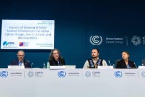
At COP30 in Belem, negotiators have again been asked to shape the planet’s future using climate science that does not reflect latest high-quality research. The problem is not the evidence itself. It is the way we organise it for global climate diplomacy.
Read more on Carbon Pulse.
In 2018, a group of Inuit youth stood before a scientific crowd at the annual ArcticNet conference in Ottawa, Canada. They spoke in Inuktitut—and observed the faces of the largely Western scientific crowd quickly turn to confusion.
For Indigenous communities in the North, the feeling of exclusion in a Western scientific space is commonplace. Researchers arriving in the Arctic often approach communities with very little consideration of linguistic barriers, historical context, or cultural differences. By flipping the script on the researchers, the Inuit youth delivered a clear message: Arctic research has an equity problem.
Read more on Permafrost Pathways.
Grazing lands as climate solutions: Key practices for carbon and biodiversity
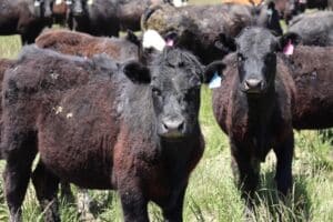
A new review of U.S. grazing land practices explores how land stewardship and ranch management practices can help fight climate change. The study identifies promising strategies—such as wetland restoration, planting legumes in pastures, and adjusting grazing intensity—that could boost soil carbon, cut greenhouse gases, and deliver co-benefits for biodiversity, water quality and soil health. But it also underscores a critical need for more research to guide long-term sustainable management.
Read more on Cool Green Science.
What the COP30 climate summit in the Amazon delivered for forests and Indigenous people

Brazil insisted on hosting this year’s COP30 climate summit in the Amazonian city of Belem to put rainforests at the heart of negotiations on how to curb global warming.
But as delegates from almost every country concluded tense talks under the rainforest’s humid heat, the outcome for trees and their guardians, though unprecedented, was bittersweet.
Tropical Forests, Forever?

As the host of this year’s UN climate treaty negotiations and home to most of the Amazon tropical rainforest, Brazil led a major advance for forests and their indigenous inhabitants called the Tropical Forest Forever Facility. The new $125 billion fund, with guarantees for investors, will send its profits to countries with documented forest preservation, including some cash going directly to indigenous and local populations. Michael Coe, a senior scientist at the Woodwell Climate Research Center who was at COP30, joins Hosts Steve Curwood and Jenni Doering to explain why forest protection is a vital piece of stabilizing the climate.
Listen or read more on Living on Earth.
September 2025— On the shores of Lago Caracaranã, deep in the Brazilian State of Roraima, a group of Indigenous brigadistas gather around printed paper maps. They have come to this lakeside meeting place from their territories across the state and beyond to learn about maps from Dr. Ray Pinheiro Alves, a research analyst at the Amazon Environmental Research Institute (IPAM). Alves directs each woman to a map of their own territory, completely unlabeled. He hands them drawing supplies, and within moments the brigadistas have oriented perfectly to the map, tracing familiar rivers, home sites, and landmarks from memory.
Roraima is Brazil’s northernmost state. It straddles the equator, and contains both native sweeping grasslands like those around Caracaranã and misty, mountainous stretches of the Amazon rainforest. It is remote, and sometimes disconnected from the rest of the country, yet experiencing the same encroachment from agriculture and illegal mining, and the same increase in destructive fires that often follow in the wake of deforestation. Which is why the Indigenous fire-fighting brigades here are eager to pick up new tools that could help them manage and protect their forests and homes.
Alves believes maps should be one of those tools. He, along with Woodwell Climate research scientist, Dr. Manoela Machado, has been spearheading a series of workshops designed to help Indigenous fire brigades build the skills of cartography and geographic information systems (GIS). Strong GIS knowledge allows fire crews to make use of data to guide decisions about both on- and off-season fire management activities— both of which will become more critical as the climate warms and fire becomes more prevalent and difficult to control.
Brazil’s fiery landscape
It is supposed to be raining in Roraima right now, but the winter has been dry this year. Climate change has been elongating dry seasons in many regions of the country, increasing the time that ecosystems are prone to burning.
In the Amazon, fires are set intentionally as a part of the deforestation process. Land grabbers use fire to clear the piled vegetation that was cut to make way for cattle ranching, which later will be converted to cropland. With climate shifts, these fires are now more likely to escape into drier and weakened surrounding forests. In Central Brazil, the savana and seasonal wetland ecosystems of the Cerrado and Pantanal have co-evolved with varying levels of frequency and intensity of fire. But prolonged drought and rising temperatures have turned fire seasons into crisis seasons.
Indigenous communities across Brazil have used fire for millennia, working with the ecosystem to promote culturally important species. With climate change extending fire seasons, traditional calendars are also shifting, as the time available for safe burning shrinks. Communities are also facing incursions into their territories from runaway fires ignited on nearby farms.
The world got a taste of the scope of the crisis in 2019 when, during an already record-breaking summer of fire, land grabbers in the Amazon intentionally set so many fires in a single day that the smoke traveled to the City of São Paulo hundreds of miles away.
“The sky in São Paulo became dark at 3pm. And then the world started paying attention to fires in the Amazon,” says Machado. Protecting Brazil’s forests from fire, especially the carbon-rich Amazon rainforest, became a much higher priority for the international community.
Brazil has an extensive wildland fire fighting system, composed of both official and voluntary brigades, supported by various government agencies to operate across private lands, protected public lands, and Indigenous territories. Amidst the increased urgency to quell fires, Machado was interested in understanding what brigades at different jurisdiction levels might need to be more effective during crisis months. She herself has extensive expertise in geospatial software and analysis and wondered whether organizations like Woodwell Climate and IPAM could help by providing data on terrain, weather patterns, vegetation type, and other field-relevant information.
So Machado and Senior Scientist Dr. Marcia Macedo, conducted a needs assessment of the firefighting system to identify what analyses might be most useful.
“The answer was a little bit different, depending on who we were talking to,” says Macedo. “But when we spoke to the Indigenous fire brigades, one of the things that came out right away was not just a desire for spatial data, but for training in spatial analysis. They wanted to be able to work with the data the same way we did.”
Two ways of knowing the land
For the Indigenous communities of Brazil, maps aren’t needed for navigating their territory the way Google Maps might be for someone walking in unfamiliar lands.
“The Indigenous peoples of Brazil have a great understanding of their territory,” says Alves. “We show them an image and they recognize some river or some landmark. They can see it immediately in the satellite view.”
Instead, geospatial data offers another way of communicating their innate knowledge of the land. For the Indigenous fire brigades Machado and Macedo spoke with, the ability to use the same GIS tools that scientists use, and make maps the way a government agency like Brazil’s Institute of the Environment and Renewable Natural Resources (IBAMA) might, is invaluable to advocating for themselves in non-Indigenous spaces.
“To be able to make their own maps can strengthen their autonomy to make decisions, and [aid in] dialogs with people about public policies,” says Alves.
Machado worked with Alves to develop the curriculum for a series of workshops that would help teach the foundations of GIS to fire brigade members from Indigenous territories across Brazil. The first was held in Brasília in 2022, and three more have followed since, the class in Roraima most recently.
Each workshop begins with the basics—latitude and longitude, hemispheres, projections. Alves is a natural teacher, and makes use of props, metaphors, and activities like drawing on the printed maps to make the concepts feel more tangible.
On later days of the workshop, as participants get familiar with QGIS, a free map-making software, Alves sometimes adapts the suggested curriculum to the needs of the communities in attendance.
“For example, in one class we were presenting topographic maps, and they said ‘this is really, really, useful for us,’” says Alves. “So we changed that part of the course to solve for the question they were dealing with.”
By the end of the course, participants have successfully created maps relevant to their own territories. Seeing their own homes represented in map form, Machado says, connects them more strongly to the material.
“You could see the pride on their face,” Machado says. “They recognize every element of that map because they built it. They made each decision of what to show on the map.”
The women’s brigade
Ana Shelley Xerente of the Xerente people had watched her husband work on their territory’s official fire brigade for 13 years before she decided she’d like to try her hand at it as well. Over the years raising her two children, she observed changes occurring in the native Cerrado ecosystem of the Xerente territory—hotter temperatures, drying streams, more fires.
“Nowadays, right after the rain, it’s basically dry,” says Ana Shelley. “All due to climate change.”
She felt a strong duty to protect the environment, and told her husband she’d like to work at Prevfogo, the firefighting arm of Brazil’s Institute of the Environment and Renewable Natural Resources (IBAMA), like him.
“He kept teasing me. ‘There’s no way you could handle that,’” Ana Shelley says. “But I kept talking about it and he came up with the idea of creating a volunteer brigade.”
Volunteer brigades support official brigades, including with that critical non-crisis season prevention work. In 2021, responding to interest from Ana Shelley and others in the territory, Prevfogo and the National Indian Foundation (FUNAI) provided support to start an all-woman volunteer brigade— the first in Brazil. Ana Shelley drove her team of 29 women from village to village, speaking to elders, educating children, re-planting vegetation around headwater streams, and discussing how climate change has affected their traditional calendar for cultural burning.
“We have our own calendar, made by our elders. It marks the rainy season and the dry season, when burning isn’t allowed. So we went through the whole territory, talking to people about what fire brings, the impact it has on humans and animals, and there was a significant reduction [in fires],” Ana Shelley says.
Ana Shelley began to stand out as a leader among the volunteers. In 2024, when her husband left his role as president of the official territory brigade to pursue work with FUNAI, she was asked to fill in for the remainder of his term. At the start of 2025, she was named president for her own four-year term, and has eagerly assumed the responsibility of organizing the activities of 74 Indigenous firefighters, both men and women.
“Everything is new to me, being a brigade chief. And since in our community it’s mostly men who call the shots, it causes an impact, because now the chief is a woman, so it’s all new to them, too,” Ana Shelley says. “I learn a lot from them, and I also share with them what I know. I’m sure it’s going to be challenging, but I also know it’s going to bring a lot of good results.”
Classroom representation
The second GIS workshop was hosted in Ana Shelley’s own territory in Tocantins, but only her husband participated in the course. In fact, midway through the workshop, Machado looked around and wondered why, in a territory with an established brigade of motivated female fire fighters, she was the only woman in the classroom.
Despite not being in operation for as long as the men’s brigades, the brigadistas were eager to perform at the same level. Perhaps, Machado wondered, the workshops could be an opportunity to level the playing field.
She suggested hosting a women’s-only brigade training to encourage their participation, giving women a chance to learn alongside others with similar experiences. The first one took place in Maranhão in June, followed by the one in Roraima.
Macedo says this kind of peer representation is critical to the success of capacity sharing efforts like this one.
“Peer-to-peer teaching and knowledge sharing among people who are living the same reality is almost always more effective than us scientists standing at the front [of a class],” Macedo says.
The brigadistas of Roraima are the clear result of women’s representation on fire brigades, which started in Tocantins with Ana Shelley and has now unfurled across the country. Roraima was the first Brazilian state to formalize all-female fire brigades with the Brigada Pataxibas— a multi-territory collective of female firefighters. During the closing ceremony for the workshop in Roraima a Tuxaua, or elderly community member honored for their wisdom, named Azila stood to point out the bravery of the women assembled, who had accomplished things she never had the opportunity to do in her youth.
Brigade participation has also begun to open doors for women even beyond their territories.
“Some have become teachers, others are in college. It has broadened their horizons. We’ve inspired many women across Brazil,” says Ana Shelley.
According to Machado, the GIS training offers all participants, men and women, the opportunity to tell their own stories on their own terms.
“Maps tell stories,” says Machado. “So the importance of all community members being able to build their own maps is that it allows them to control the narrative. They control how their story is told, instead of waiting for someone else to build a map and tell the story for them.”
The future of fire management
For now, the workshops are planned and hosted on an ad hoc basis, as funding allows. But Macedo sees a pressing need to scale up. The more brigades participate, the more excitement grows for the material.
“If we offered one of these a month for a while, we still wouldn’t be able to meet the demand for them,” says Macedo.
At some point, Macedo says, the project will have to shift to a “training the trainers” strategy. The team envisions a model where the most engaged workshop participants are taught the skills needed not just to make maps but to teach others, expanding this knowledge further and faster than Alves, Machado, and Macedo could on their own. Technology access is another limiter. Some Indigenous communities have access to laptops at central headquarters but it is not common for each community to have its own laptop and almost no individual brigade members do. More laptops would allow workshop participants to continue practicing their skills on their own time.
Policies in Brazil have also begun to shift to open additional opportunities. In 2024, the country passed a new Integrated Fire Management law that will require greater coordination among different brigade jurisdictions for pre-season and mid-season firefighting activities. The law places a specific emphasis on incorporating traditional knowledge. Macedo says she thinks the GIS workshops could contribute to this greater movement and help position Indigenous communities as central to the country’s fire management policies.
When Ana Shelley reflects on how much her brigades have already been able to accomplish, and the possibilities on the horizon, she is hopeful.
“I see a much better future.”