In the Amazon Rainforest, there is no such thing as a natural fire. Yet every year we see headlines of rainforest vegetation aflame, smoke drifting across populated areas, and stored carbon spilling into the atmosphere. So how does a rainforest—one of the wettest ecosystems on Earth—catch fire?
Climate impacts on Amazon fire
Whether directly or indirectly, human activities are the root cause of fire in the Amazon.
In order for a fire to start anywhere, you need three things— favorable climatic conditions, a fuel source, and an ignition source. In the Amazon, each side of this “triangle of fire” has been exacerbated by warming temperatures and deforestation, creating flammable conditions that can allow fires to spread out of control deep into the forest once they are ignited.
Climate conditions
High temperature and dryness combine to create the right conditions for fires to spread through the Amazon. As global temperatures have risen, the Amazon region has become hotter and drier, more vulnerable to prolonged droughts and extreme climatic events. Most recently, a climate-driven drought spanning 2023 and 2024 has deeply impacted water levels in the forest— to the point of isolating riverside communities.
Wildfire danger days, or days considered hot and dry enough to increase the likelihood of fire, have become a much more common occurrence deeper in the Amazon, where previously it was just too wet to burn.
Fuel
Felled trees and dry vegetation form the fuel for more fires in the Amazon. How do the trees fall? Some are killed in extreme drought and previous fire, but many are intentionally cut, pushed over by bulldozers for conversion of forest to pasture land. Large-scale deforestation has been advancing into the Amazon for decades, fragmenting thick blocks of forest and replacing them with ranch or farm land. Scientists and activists have been pushing for an urgent stop in deforestation to achieve, among other benefits, a drop in fire numbers. However, despite slowly declining deforestation rates, fires are still increasing, pointing to another important piece of the puzzle – degradation.
When a forest is fragmented by deforestation, it degrades the vegetation that remains standing. Forests along the edges of clearings dry out and weaken, making them more susceptible to future burning. And burning weakens nearby forests yet again, creating more available fuel, setting off a chain of degradation.
Ignition
Ignition in the Amazon is almost entirely human caused— whether accidentally or intentionally. Ranch and farm operations both legally and illegally clearing Amazon rainforest use fire to burn away cut vegetation or prepare existing pasture land for other uses. With climate change creating hotter and drier conditions, and lengthening the dangerous dry season, any ignition becomes potentially risky, whether or not its use is legalized. Especially where forest edges have already been weakened.
However, a study led by Woodwell Climate Postdoctoral Researcher and fire ecologist Dr. Manoela Machado, found that long-term solutions to the Amazon’s fire crisis will require distinguishing between the complex uses of fire. One-size-fits-all fire bans, usually employed as emergency measures and not always strictly enforced, may reduce fire in the short term, but don’t adequately address the underlying reasons people have decided to burn the land.
Ending deforestation and supporting firefighters
Fire in the Amazon follows deforestation and degradation, namely from logging, fires, droughts and fragmentation. Climate change and human encroachment have worked in concert to foster a devastating annual burning regime in the Amazon rainforest that threatens one of the Earth’s most valuable mechanisms for keeping the planet cool.
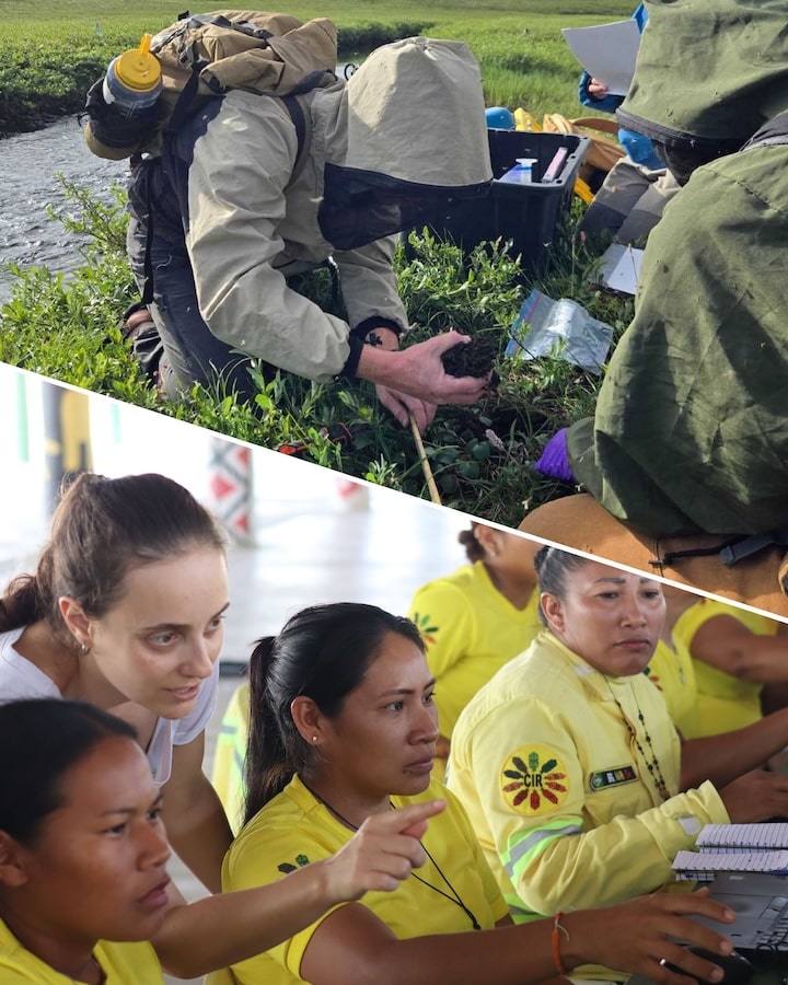
Eliminating fire from the Amazon will require the elimination of deforestation and degradation sources, as well as the enforcement of strategic fire bans and support of firefighting brigades. Machado, has led several successful workshops with Indigenous fire brigades in Brazil, bringing together groups from across the country to learn about Geographic Information Systems (GIS) technology they can use to monitor and manage their own forests.
According to Machado, a big part of fire prevention happens in the off-season. Support for activities like community outreach, building fire breaks in collaboration with farmers, and technical assistance to replace legal use of fire, can all help reduce the prevalence of catastrophic fires when the dry-season comes around.
The Amazon is a massive place, and firefighting can be a dangerous job. Especially on the frontiers of deforestation, where land grabbing and illegal deforestation are common and fire fighters are often threatened to stay out of an area. Ultimately, government support, bolstered enforcement of deforestation laws, and viable alternative livelihoods have a major role to play in bringing down fires, alongside continued global efforts to curb climate change.
New legislation proposed in the U.S. Senate would for the first time consider the importance of monitoring permafrost thaw as part of a broader effort to improve U.S. weather forecasting and modeling, and support cutting-edge tools and resources to better track this serious environmental hazard in the North.
Read more on Permafrost Pathways.
Fire is a necessary element in northern forests, but with climate change, these fires are shifting to a far less natural regime— one that threatens the ecosystem instead of nurturing it.
Boreal tree species, like black spruce, have co-evolved over millennia with a steady regime of low-frequency, high-intensity fires, usually ignited by lightning strikes. These fires promote turnover in vegetation and foster new growth. On average, every 100 to 150 years, an intense “stand-replacing” fire might completely raze a patch of forest, opening a space for young seedlings to take root.
But rapid warming in northern latitudes has intensified this cycle, sparking large fires on the landscape more frequently, jeopardizing regeneration, and releasing massive amounts of carbon that will feed additional warming. Here’s how climate change is impacting boreal fires.
Climate Impacts on Boreal Fire
In order for a fire to start, you need three things— favorable climatic conditions, a fuel source, and an ignition source. These elements, referred to as the triangle of fire, are all being exacerbated as boreal forests warm, resulting in a fire regime with much larger and more frequent fires than the forests evolved with.
Climate conditions
Forest fires only ignite in the right conditions, when high temperatures combine with dryness in the summer months. As northern latitudes warm at a rate three to four times faster than the rest of the globe, fire seasons in the boreal have lengthened, and the number of fire-risk days have increased.
In some areas of high-latitude forest, climate change has changed the dynamics of snowfall and snow cover disappearance. The rate of spring snowmelt is often an important factor in water availability on a landscape throughout the summer. A recent paper, led by Dr. Thomas Hessilt of Vrije University in collaboration with Woodwell Associate Scientist, Dr. Brendan Rogers, found that earlier snow cover disappearance resulted in increased fire ignitions. Early snow disappearance was also associated with earlier-season fires, which were more likely to grow larger— on average 77% larger than historical fires.
Fuel
The second requirement for fires to start is available “fuel”. In a forest, that’s vegetation (both living and dead) as well as carbon-rich soils that have built up over centuries. Here, the warming climate plays a role in priming vegetation to burn. A paper co-authored by Rogers has demonstrated temperatures above approximately 71 F in the forest canopy can be a useful indicator for the ignition and spread of “mega-fires,” which spread massive distances through the upper branches of trees. The findings suggest that heat-stressed vegetation plays a big role in triggering these large fires.
Warming has also triggered a feedback loop around fuel in boreal systems. In North America, the historically dominant black spruce is struggling to regenerate between frequent, intense fires. In some places, it is being replaced by competitor species like white spruce or aspen, which don’t support the same shaded, mossy environment that insulates frozen, carbon-rich soils called permafrost, making the ground more vulnerable to deep-burning fires. When permafrost soils thaw and burn, they release carbon that has been stored—sometimes for thousands of years—contributing to the acceleration of warming.
Ignition
Finally, fires need an ignition source. In the boreal, natural ignitions from lightning are the most frequent culprit, although human-caused ignitions have become more common as development expands into northern forests.
Because of lightning’s ephemeral nature, it has been difficult to quantify the impacts of climate change on lightning strikes, but recent research has shown lightning ignitions have been increasing since 1975, and that record numbers of lightning ignitions correlated with years of record large fires. Some models indicate summer lightning rates will continue to increase as global temperatures rise.
There is also evidence showing that a certain type of lightning— one more likely to result in ignition— has been increasing. This “hot lightning” is a type of lightning strike that channels an electrical charge for an extended period of time and tends to correlate more frequently with ignitions. Analysis of satellite data suggests that with every one degree celsius of the Earth’s warming, there might be a 10% increase in the frequency of these hot lightning strikes. That, coupled with increasingly dry conditions, sets the stage for more frequent fire ignitions.
Fire Management as a Climate Solution
So climate change is intensifying every side of the triangle of fire, and the combined effects are resulting in more frequent, larger, more intense blazes that contribute more carbon to the atmosphere. While the permanent solution to bring fires back to their natural regimes lies in curbing global emissions, research from Woodwell Climate suggests that firefighting in boreal forests can be a successful emissions mitigation strategy. And a cost effective one too— perhaps as little as $13 per metric ton of carbon dioxide avoided, which puts it on par with other carbon mitigation solutions like onshore wind or utility-scale solar. It also has the added benefit of protecting communities from the health risk of wildfire smoke.
Rogers, along with Senior Science Policy Advisor, Dr. Peter Frumhoff, and Postdoctoral researcher Dr. Kayla Mathes have begun work in collaboration with the Yukon Flats National Wildlife Refuge in Alaska to pilot this solution as part of the Permafrost Pathways project. Yukon Flats is underlain by large tracts of particularly carbon-rich permafrost soils, making it a good candidate for fire suppression tactics to protect stored carbon.
The project will be the first of its kind— working with communities in and around the Refuge as well as US agencies to develop and test best practices around fighting boreal fires specifically to protect carbon. Broadening deployment of fire management could be one strategy to mitigate the worst effects of intensifying boreal fires, buying time we need to get global emissions in check.
In recent public comment, scientists at Woodwell Climate Research Center warn against the use of the Inflation Reduction Act’s (IRA) clean electricity tax credits to support biomass as an effective clean energy solution. Scientists cited its higher carbon footprint per unit energy compared to burning fossil fuels, and highlighted that claims to offset these emissions by planting trees are misleading, as new trees take decades to centuries to recapture lost carbon. The comment, submitted in response to the Internal Revenue Service (IRS) and U.S. Department of Treasury’s proposed guidance on the Clean Electricity Production Credit and Clean Electricity Investment Credit, advocates for more rigorous guardrails from the agencies regarding the use of wood for bioenergy, greater regulatory clarity, and more accurate accounting of emissions from wood-burned fuel.
The Clean Electricity Production and Investment Credits were designed to provide incentives “to any clean energy facility that achieves net zero greenhouse gas emissions.” The proposed guidance, released in June, is intended to clarify and add certainty around how to measure and define “net zero,” and how clean energy production facilities can qualify for these incentives.
In their comment, however, scientists emphasize more work must be done to achieve this goal: “The content of the proposed guidance is ambiguous or even conflicting about some parts of the rule regarding sources of forest bioenergy,” they write. “Parts of the guidance should be made much clearer and more definitive to ensure that there are no unintended consequences. Guardrails could be put in place to avoid the many ways that increasing use of wood for bioenergy would increase emissions rather than having the desired effect of decreasing emissions. It is also important to consider the many values of forests beyond climate mitigation, such as timber, biodiversity, water, and recreation.”
Scientists also note the proposed guidance does not properly account for the net emissions associated with forest bioenergy – all of which contribute to its high carbon footprint and add to concerns from experts that biomass can actually worsen the climate crisis – including those from harvesting intact forests, logging debris, transporting woody biomass, and converting biomass to fuel, as well as from feedstock, fertilizers, and forest management practices like thinning, where live trees are removed to reduce wildfire risk or promote forest growth, and more.
Because many of these emissions are left out, the proposed guidance overestimates the potential of forest bioenergy to achieve the IRA’s intended goal of lowering emissions, and further fuels incorrect assumptions that biomass energy is an effective, carbon-neutral alternative to fossil fuels.
Throughout the comment, scientists offer recommendations to help decision makers more accurately incorporate and represent these emissions in policy. For example: 1) account for both direct and indirect emissions; 2) avoid the fallacy of assuming carbon neutrality; and 3) take a case-by-case approach to calculate the counterfactual emissions, or what the emissions would have been had the wood or biomass not been used for bioenergy; among others.
Hurricane season in North America is underway. Already, the second storm of the year to earn a name, Beryl, has cut a destructive swath across the Caribbean and the United States. This year, the National Oceanic and Atmospheric Administration (NOAA) forecasted an extremely active hurricane season, anticipating between 17-25 named storms (the average is 14) and 4-7 major storms (average is 3). Major storms are category 3 and above with wind speeds exceeding 111 mph.
Intense seasons like this are likely to be a more common occurrence in a warmer world, as higher temperatures, rising seas, and changing weather patterns create the conditions for bigger, more destructive, longer lived, and more rapidly strengthening storms. Here’s how climate change is affecting the Atlantic hurricane season:
1. Higher temperatures mean more energy to form hurricanes
To understand how hurricanes are being affected by climate change, it’s important to understand how hurricanes are formed. They are essentially clusters of thunderstorms, building strength as they sweep westward using the energy from warm tropical waters. Under the right conditions, the Earth’s rotation will cause the cluster to spin into a cyclone shape. Because heat is energy, increases in sea surface temperatures play a critical role in strengthening these storms.
The ocean is a major heat sink for the planet, absorbing over 90% of the excess heat trapped by greenhouse gasses in the Earth’s atmosphere over the past few decades. Global sea surface temperatures have increased approximately 2.8F since the beginning of the 20th century, and ocean heatwaves — large areas of above-normal temperatures that can last for months-– are much more common and widespread. A hotter ocean means there is more energy available to fuel tropical storms, ultimately making it a more destructive event when it hits land.
2. The hotter the air, the more water it can hold
The second thing a hurricane needs to form is moisture. Water is evaporated and pulled up into the developing storm as it spins across warm waters of the tropical Atlantic. Hotter air temperatures mean more moisture can be held as vapor in the atmosphere, which allows storms to ingest greater amounts of water that will eventually condense into clouds and be released as rainfall. Condensation also releases heat into the storm, fueling its intensification. Models estimate that human-caused global warming has increased hurricane extreme hourly rainfall rates by 11%.
3. ENSO fluctuations are becoming more extreme
Climate change is also contributing to larger swings between the two phases of the El Niño Southern Oscillation (ENSO)—meaning stronger versions of both El Niño or La Niña patterns. Currently, the Atlantic is headed towards a La Niña, which favors hurricane formation because it lessens vertical wind shear. Differences in wind speeds at different heights in the atmosphere can tear a storm apart, while less shear (more consistency in wind speeds between altitudes) allows storms to stay together and build strength.
4. Tropical storms are undergoing rapid intensification more frequently
All these factors add up to more intense tropical storms in a world altered by climate change— meaning more category 3-5 storms and more big storms back-to-back. Since 1975 the number of category 4-5 cyclones has roughly doubled.
This doesn’t necessarily mean that there will be more hurricanes; however, the ones that do form can be bigger and cause more damage (on top of the already estimated $2.6 trillion in damages since 1980.) If anything, data shows a slight decrease in the number of storms, moving more slowly along their path, releasing their extreme wind and rain over a single location for longer periods.
5. Rising sea levels are making hurricanes more deadly
Sea level rise due to climate change has also made hurricanes a more dangerous threat for more people. As sea levels rise, coastlines are put at increased risk of flooding.
Sea levels have risen roughly 8 in since the late 19th century, and the rate of rise is accelerating as climate change worsens. When a hurricane makes landfall, water is pushed inland by high-speed winds in an event known as storm surge. Every additional inch of sea level rise allows the surge to travel farther inland, threatening a wider area and causing more damage, death, and injury— especially in areas where human development along the coast has exposed people and homes to greater risk.
As temperatures continue to rise, communities along the East and Gulf coasts can expect to be hit harder by destructive storms. Despite this, more and more people are choosing to live and build along the coasts, increasing the cost of damages when hurricanes do strike. Slowing warming temperatures and building adaptation measures to protect coastal communities will become more urgent as Atlantic hurricanes intensify.
Despite facing regional threats like deforestation and wildfires, the world’s forests continue to be a powerful weapon in the fight against climate change. A new study reveals these vital ecosystems have consistently absorbed carbon dioxide for the past three decades, even as disruptions chip away at their capacity. The study, based on long-term ground measurements combined with remote sensing data, found that forests take up an average of 3.5 ± 0.4 billion metric tons of carbon per year, which is nearly half of the carbon dioxide emissions from burning fossil fuels between 1990 and 2019.
The study titled “The enduring world forest carbon sink,” published in the June issue of the journal Nature, highlights the critical role of forests in mitigating climate change. The study further shows that deforestation and disturbances like wildfires are threatening this vital carbon sink.
The research is co-led by U.S. Department of Agriculture (USDA) Forest Service Northern Research Station Senior Research Scientist Yude Pan and Woodwell Climate Senior Scientist Richard Birdsey, and includes 15 additional co-authors from 11 countries.
Some of the key findings include:
- Boreal forests in the Northern Hemisphere, spanning regions like Alaska, Canada, and Russia, have experienced a significant decline in their carbon sink capacity, dropping by 36%. This decrease is attributed to factors including increased disturbances from wildfires, insect outbreaks, and soil warming.
- Tropical forests have also seen a decline, with deforestation causing a 31% decrease in their ability to absorb carbon. However, regrowth in previously abandoned agricultural lands and logged areas has partially offset these losses, keeping the net carbon flux in the tropics close to neutral.
- Temperate forests, on the other hand, have shown a 30% increase in their carbon sink capacity. This rise is largely due to extensive reforestation efforts, particularly in China.
“Our research team analyzed data from millions of forest plots around the globe,” Pan explained. “What sets this study apart is its foundation in extensive ground measurements – essentially, a tree-by-tree assessment of size, species, and biomass. While the study also incorporates remote sensing data, a common tool in national forest inventories and landsurveys, our unique strength lies in the detailed on-the-ground data collection.”
“The persistence of the global forest carbon sink was a surprise given global increases in wildfire, drought, logging, and other stressors,” according to Birdsey. “But it turns out that increasing emissions in some regions were balanced by increasing accumulation in other regions, mainly re-growing tropical forests and reforestation of temperate forests. These findings support the potential for improving protection and management of forests as effective natural climate solutions.”
The study describes how certain land management policies and practices can help preserve this global carbon sink. According to co-author Professor Oliver Phillips from the University of Leeds, who coordinates the pan-tropical ForestPlots.net coalition of scientists supporting key networks such as AfriTRON and RAINFOR, “the extraordinary persistence of the carbon sink shows that forests have mostly coped with climate change, so far. Deforestation, fire, and logging are damaging forests everywhere, but drought less so. Helping Earth’s forests resist climate change will mean keeping them as intact, healthy and vibrant ecosystems.”
Findings support a focus on curtailing deforestation across all forest biomes, for example, promoting forest restoration on lands that may be unsuitable for agriculture, and improving timber harvesting practices to minimize emissions from logging and related activities. The research also highlights the limitations in data collection, particularly in tropical regions. The study calls for increased research and establishment of more ground sampling plots in these areas to reduce uncertainties in carbon estimates and improve understanding of the global carbon budget.
On May 18th, Morris Alexie, Permafrost Pathways Tribal Liaison for the Alaska Native Village of Nunapicuaq (Nunapitchuk), traveled for three days to South America to join EarthRights International and other Indigenous leaders from around the world at the Public Hearing on the Advisory Opinion on Climate Emergency and Human Rights.
Read more on Permafrost Pathways
A new study, just published in the journal Nature Communications Earth & Environment, finds that severe droughts in the Amazon basin over the last two decades have led to longer periods of low water levels and triggered profound impacts on the local population.
The severe droughts in 2005, 2010, and 2015-2016, in particular, not only drastically reduced water levels in a substantial part of the world’s largest river system, but also resulted in low water level periods exceeding 100 days, a month longer than expected.
These droughts have major impacts on rural, remote Amazonian communities who heavily rely on inland water transport to access goods and services, reach urban centers, and maintain their livelihoods. The study concludes that during severe droughts, when such water transport is not available, nearly 50% of non-Indigenous localities and 54% of Indigenous villages in the Brazilian part of the Amazon basin are prone to isolation. These droughts also expose Amazonian communities to scarcity of goods, restricted access to healthcare and education, limited access to fishing and hunting sites, and other major impacts.
“This is the new reality of the Amazon,” said Dr. Letícia Santos de Lima, researcher at the Institute of Environmental Science and Technology of the Universitat Autònoma de Barcelona (ICTA-UAB) and lead author of the study. “Scientists have been warning for years that the Amazon basin is facing a substantial increase in the frequency and intensity of extreme events due to climate change, on top of severe changes in its hydrological system due to deforestation and forest degradation. These past droughts as well as the most recent one, 2023-2024, are showing that the impacts on the ecosystems extend severely to the Amazon population.”
“The Amazon faces increasingly severe droughts due to global warming, with very real consequences for the communities that live there,” added Dr. Marcia Macedo, Woodwell Climate Research Center scientist and study co-author. “To better prepare for these extreme climate events, we need climate solutions that prioritize water resources alongside efforts to curb carbon emissions. This will be key for sustaining resilient ecosystems and communities in the Amazon and around the world.”
The paper states that “actions to cope with recent droughts in the Amazon have been reactive rather than proactive and grounded in preparedness and adaptation principles,” and calls for Amazon countries to “develop long-term strategies for mitigation, adaptation, and disaster response.” The authors also stress that any solutions to isolation must not also worsen the problem. For example, roads would not be an effective solution as they are a well-known driver of deforestation, which leads to changes in rainfall, contributes to a higher volume of sediments in rivers, and would impair navigability even further.
Using an interdisciplinary approach, researchers combined spatial analysis, methods from hydrology, and news media content analysis to deliver the first spatiotemporal assessment of cross-sectoral impacts of droughts in the Amazon basin.